Narva Maps and Orientation
(Narva, Ida-Virumaa, Estonia)
With a population of around 70,000 people, Narva is one of the most sizable and significant of Estonia's cities and lies on the far north-eastern coastline of the country, alongside the border to
Russia and the Russian state of Leningrad Oblast.
The city is based around the prominent Narva River, which links to the nearby freshwater lake named the Peipus, the fifth biggest of all the lakes in Europe. Central Narva's most eye-catching landmark is its imposing castle, which stands alongside the river itself and directly south of the Estonian-Russian bridge.
Maps and Orientation of the City
Both the bus and railway stations in Narva are conveniently next to each other and situated along the Vaksali Tänav. From here, Narva Castle is just a stone's throw away and can be reached along the Pushkini Tänav. Maps and guides to the city are available from the Narva Tourist Office, which is located on the Pushkini Tänav, while free Internet access is available at the public library, a short walk to the east, on the Maimi Pushkini Tänav.
- Johvi - 48 km / 30 miles (55 minutes, west)
- Kivioli - 79 km / 49 miles (one hour and 20 minutes, west)
- Kohtla Jarve - 60 km / 37 miles (one hour and ten minutes, west)
- Kuremäe - 64 km / 40 miles (one hour and ten minutes, south-west)
- Luganuse - 74 km / 46 miles (one hour and 15 minutes, west)
- Maardu - 202 km / 126 miles (three hours, west)
- Mehide - 86 km / 53 miles (one hour and 25 minutes, south-west)
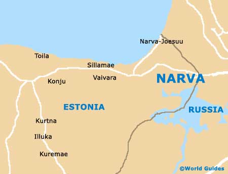
- Narva Joesuu - 12 km / 7 miles (15 minutes, north)
- Pussi - 75 km / 47 miles (one hour and 15 minutes, west)
- Rakvere - 116 km / 72 miles (one hour and 50 minutes, west)
- Sillamae - 29 km / 18 miles (35 minutes, west)
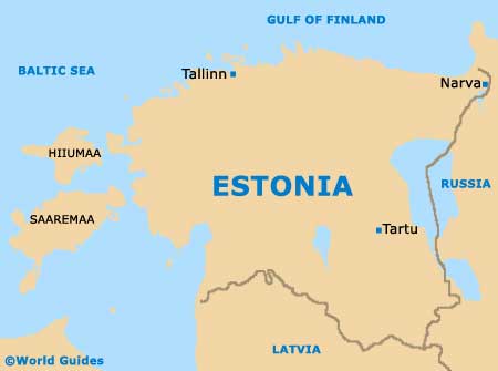
- Tallinn - 212 km / 132 miles (three hours and 15 minutes, west)
- Tapa - 146 km / 91 miles (two hours and 20 minutes, west)
- Tartu - 180 km / 112 miles (two hours and 45 minutes, south-west)
- Unikula - 82 km / 51 miles (one hour and 20 minutes, west)
Map of Estonia
Map of Narva